Contacto : cgeofisica@gmail.com

Ciencia y Geofísica

Grupo IGPERU

Ciencia y Geofísica

facebook
instagram
linkein
whatsapp
  • Meteorología y Climatología

    Estudiamos el comportamiento de los fenómenos atmosféricos!

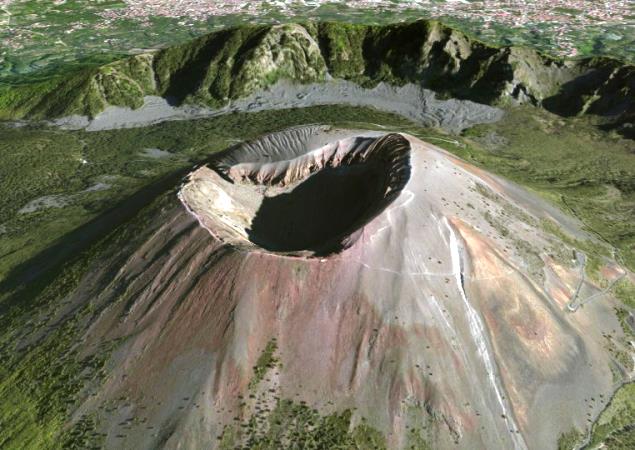
  • Volcanología

    Estudiamos el comportamiento de los volcánes!

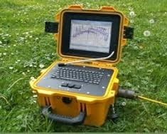
  • Prospección Geofísica

    Estudiamos técnicas físicas y matemáticas, aplicadas a la exploración del subsuelo para la búsqueda de recursos naturales y yacimientos minerales.

  • Geotermia

    Estudiamos los fenómenos térmicos que tienen lugar en el interior de la Tierra.

  • Tectonofísica

    Estudiamos la dinámica y cinemática de los procesos que deforman a la litosfera mediante métodos cuantitativos.

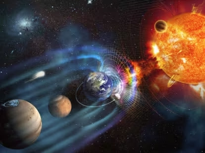
  • Geomagnetismo

    Estudiamos las propiedades magnéticas de la Tierra.

  • Inteligencia Artificial

    Aplicando los conocimientos en Inteligencia Artificial para convertir la Geofísica más inteligente.

GEOPHYSICS! (English Version)

Now we have to talk a bit of geophysics, a small part of what is working, that it would be normal to present a geophysical report for a company, I'm talking about cuts geoelectric or geoelectric profiles which are very important in a job geophysical exploration and interpretation because help a lot us when we are working on for minerals or in finding groundwater or in the search for groundwater reservoirs. But how can we use the geoelectric profiles to find what I point?

Geoelectric profile.
First we must understand that the geoelectric profiles are an indirect and secondary geophysical work, because the data are first taken in the field, depending on the type of work that Realize, to develop these
profiles at the end of the report help us to interpret what we find and express well our findings indicating after our recommendations.

Ok! Geoelectric profiles are a manifestation of the data collected in the field when the inject field by returning a value, which collect and then draw them on logarithmic paper and get our raw data that will later be accommodated or soft for interpretation.

When we want to say that raw data is the data directly collected from the field and the team, and have not been corrected or modified if you have bad data grouped.

This data field will give us an idea of ​​what we found in the basement and that will allow computer programs using our curves soften and then generate our geoelectric profiles.
You remember how it works in the field of SEV see our videos at: http://geofisica-guszav.blogspot.com/2011/02/sondaje-electrico-vertical-sev.html 
To develop our geoelectric profile must take into account the following:

1. Data obtained from the field using our equipment resistivities.
2. Development of geoelectric curves indicating the number of layers or strata encountered and the resistivities found for that layer or stratum.
3. Materials desktop, like pencils, paper log, etc..
4. Resisitividades table of geological materials, soil and rock types, including minerals.
5. Geological maps of the study area, will help us to get an idea of what we might have in the ground to a certain depth.
Ok! We have everything to make our profile geoelectric! What now? The traditional method can be used in geophysics for geoelectric profiling is the SEV method, what does? Sev is the Spanish acronym Vertical Electrical Sounding, which in short, would be to inject current to ground at a single point to determine the number of strata or layers encountered when current injected, and at the time we returned the apparent resistivity found at greater depths. But when we want to develop our geoelectric profiles must use at least two SEV, is the minimum amount in order to draw a geoelectric profile to interpret. After having our SEV available, what we must do now is to group such as SEV 1 and SEV 2 SEV 3, and to then use another profile with other SEV, eg, SEV 4 SEV 5 to SEV 6; or this other way, SEV 1, SEV 3 and SEV 5. These distributions depend on the characteristics of the land or raw curves of the field. In any situation also depend on the criterion that has the group the SEVS geophysicist properly.

After having grouped our SEV start drawing geoelectric profiles.

Firstly, we get a table indicating each SEV our horizons and simultaneously in each horizon to indicate the layer thickness and the resistivity found for that stratum. Once this is done for all SEV proceed to draw.

First, we draw vertical lines for our SEV 1 SEV SEV 2 and 3 (take these SEV as an example). In these vertical lines will place thicknesses numerical values ​​we found when relizamos our papers logarithmic curves for all horizons found also for each SEV.
Second, we work with all first SEVS horizons of all, drawing the thickness indicating its numerical value. So do all the SEVS. This is when we work with thickness, but if we work with the situation is different depths. But we will work with thicknesses practical use.
Third, to advance to the second horizon of all we calculate SEVS because this picture should be at an appropriate scale, placing each SEV thickness, and so on until all the existing horizons for all SEVS.
and fourth, when completed this we draw the boundaries of the strata by matching the thickness of all SEVS E1, E2 thickness then all SEVS and so on for all SEVS, finally indicate the resistivity stratum found in each SEV.
So simple is to develop a profile geoelectric obviously special computer software will allow me to do this, but it's always good to know how to perform hand these profiles to learn how to really work, remember
that software is created for us to save time, but also good to know the method we are using, so in this way it will be easier to develop our interpretations and conclusions.

I offer some special bibliographies that you can use in your geophysical survey.

Of course some videos: Just check out the entry in http://geofisica-guszav.blogspot.com/2011/02/sondaje-electrico-vertical-sev.html

Any suggestions, comments, questions or concerns please cause me to know marvar26@gmail.com
NOTICIAS DEL BLOG!

Nuestro Blog Ciencia y Geofísica 2013 tiene el grato momento de avisar a todos nuestros usuarios fieles a nuestro Blog y a todos los usuarios del mundo que nuestros técnicos internos han tomado la iniciativa de agregar un nuevo formato a nuestro Blog, mostrando las nuevas versiones en el Idioma Inglés para que nuestro publico de dominio de este idioma también puedan disfrutar de nuestras informaciones relevantes e importantes sobre esta temática.

Es de esta manera nos hemos puesto el gran objetivo de llegar a más público internacional manejando otros idiomas internacionales. Tenemos la mira de llegar a usuarios de nuestros hermanos de Brasil en lo cual ya les estaremos comunicando.

Es así, que cuando visualices alguna entrada que más te guste podrás ver en la parte superior de la misma un link donde te indicará "English Version" donde podrás ingresar y leer la temática en ese idioma.

Esperamos que esta iniciativa llegue a ser una experiencia gratificante para nuestros usuarios fieles. Ciencia y Geofísica 2013.

TECHNOLOGY! (English Version)

Lately on the internet is talking and arguing about the use and concept of Free Software, so much so that it has come to misinterpret this beautiful concept for my opinion should be implemented everywhere and anytime in a natural and free without any entity to discutirnos. But what is free software? What is happening in the world of computers and the Internet? Or in a important company? The concept of free software is easy to understand yet is a deep concept. 

Free Software
See Free Software is the name of the software that respects users' freedom about your product and that once obtained may be used, copied, studied, modified and redistributed freely. But usually this term can confuse free software with free software, in other cases as freeware (here is the nest of problems). Sometimes free software or freeware may include the source code of the program but not free in the same sense that free software, unless you are guaranteed copyright or distribution or as modifications, always be careful in this regard or we would have problems in the future. 

On occasion also confuse the concept of free software in the public domain software, which requires no license because its use is forever and does not expire and it will belong to all. Interesting! But always making sure that the author of this software is expired so to speak. (Wikipedia) 

But as I said there have been misunderstandings regarding this topic. I explain a bit .. if you find a software program or online or will provide a program in your company and you notice that it is "free software" What would? Would you modify the program code? What would copy or distribute it freely to others? What would I do? If you would have online storage servers for different users can download the program would allow it? First you have to investigate the origin of the program, so the software is free, you must always remember the Author of this free software. Just look at the case of storage service Megaupload, know if it sounded on the Internet and in the news about the closure of this service and that members working in this website were taken to jail, but why? By the simple fact of not observing the Copyright Software. The problem also exists on the regulations and laws that have the different countries on this controversial topic. Who would win .. You or the Law? What injustice! I believe that freedom of knowledge must always exist in every sphere. But who benefits? It is obvious the company that creates the software because apparently you credit would be removing their software. 

Uhm .. I support the free software I am aware that if I did not create the software first be respected simply its author and thank him for his contribution and to modify the original has been said. 

But also .. Where free software promotion, they say over there that Free Software is inherited from Hacker culture which argues that software is to disseminate knowledge and smoothly and freely, simply would not do attitude antisocial and the possibility of modifying software is a form of freedom of expression. So also did the concept of Linux and its variants exist. (Wikipedia) 

But what are the advantages of free software? Just list them: low cost of acquisition, technological innovation, vendor independence, public scrutiny and adaptation of software. That's why currently public institutions, administrative and state are seriously considering implementing the concept of free software in their companies and governments, these are the cases of Venezuela Mexico, Spain, Brazil and other countries. Interesting! (Wikipedia) 

But it's always good to know opinions about major characters. Follow this link to read an interview with the Doctor in Computer Llorenç Valverde about Free Software

Here is a little video ..! 

And so you know, to be careful with Free Software!

If you observed a mistranslation write a comment to correct it.

GEOFÍSICA!

En esta oportunidad hacemos un recorrido por la Red para poder encontrar más información sobre Geofísica para que esta misma esté al alcance de todos los interesados en esta temática, es así que investigando y rebuscando por Internet hemos podido encontrar los siguientes Laboratorios Geofísicos interesantes y más relevantes del mundo.

Cada día iremos actualizando con mayor contenido sobre estos laboratorios que también pueden ser Aulas Virtuales que brindan asesoramiento o información detallada de estudio para estudiantes o profesores sobre esta rama de estudio que es la Geofísica.

Solo tienes que hacer clic en los vínculos, nosotros te daremos la guia para que puedas accesar rápidamente y puedas disfrutar de estos contenidos.

1. Aula Virtual USB.

Es una Aula Virtual venezolana donde podremos accesar al Area de Ciencia de la Tierra previa inscripción llenando un simple formulario donde llenaremos nuestros datos como Nombres y Apellidos, e-mail, nombre de usuario y contraseña.Encontraremos cursos que nos podemos inscribir y seguir. Allí podremos descargar material informativo, software, actividades dependiendo del curso en cuestión.

Aula Virtual USB (link de ingreso) | Video Guía |


NOTICIAS DEL BLOG!

Nuestro Blog Ciencia y Geofisica 2013 hace de conocimiento a nuestros usuarios y visitantes de la Red que se ha actualizado la página de entrevistas y especiales en .mp3 por lo que podrán visitarla desde el siguiente link http://geofisica-guszav.blogspot.com/p/entrevistas-y-especiales-en-mp3.html y así poder disfrutar de las descargar gratuitas para todos Uds. Estamos complacidos siempre en brindarles la mejor información disponible de la web para todos ustedes. El Equipo de Ciencia y Geofísica 2013. Cualquier consulta o comentario pueden realizarlo en nuestro Blog, cuenta de Facebook o escribenos un e-mail a marvar26@gmail.com

NOTICIAS DEL BLOG!

Nuestro blog Ciencia y Geofisica 2013 muestra sus condolencias por el fuerte sismo, "terremoto", ocurrido hoy sábado 20 de Abril del 2013 dejando un saldo hasta el momento de 113 personas fallecidas en el país hermano de China, ocurrido en la provincia Sichuan en ese país. Rogamos al Todopoderoso desde Perú que no suba el saldo de fallecidos. Nuestro Blog se une en estos momentos de dolor. Fuerza hermanos. Para mayor información sobre esta tragedia visita este link http://spanish.peopledaily.com.cn/31614/8215661.html 

GEOFISICA!


Cabe vez que comento o menciono sobre Geofísica me da gusto saber que pude elegir bien la profesión que escogí estudiar y es que la Geofísica tiene tantas materias por investigar  de diversas formas y maneras que nos faltaría el tiempo en poder terminar de hacerlo.

Nuestro blog se compromete en brindarles mayor información sobre Laboratorios Geofísicos alrededor del Mundo para tener una mayor base de datos posibles. Y es que el Geofísico es tan ingenioso que desde hace mucho tiempo viene trabajando junto con laboratorios cada vez que realiza estudios de campo o interpretaciones cuantitativas; pero nunca llegué a imaginar un laboratorio geofísico subterráneo donde se realicen estudios geofísicos sobre mareas terrestres, gravimetría y calibración de gravímetros. ¡Pues es cierto! Ya que existe desde el año 1972 en el Valle de los Caídos, en la sierra noroeste de Madrid, España. En este laboratorio geofísico subterráneo ubicado en el subsuelo de la basílica del Valle de los Caídos han podido trabajar científicos españoles, alemanes y finlandeses. Incluso fue catalogado como uno de los mejores laboratorios más sotisficados de toda Europa.

Lo que hace ideal el funcionamiento de este laboratorio es su muy buena ubicación en dicho lugar debido a que puede presentar unas condiciones muy favorables, por no decir excepcionales, de una gran estabilidad, que permite hacer de forma magnifica las medidas geodésicas. Fuente:http://www.elvalledeloscaidos.es/portal/archives/3282

En las instalaciones de dicho laboratorio geofísico subterráneo existen las siguientes estaciones: un laboratorio subterráneo de mareas terrestres, una estación de gravedad absoluta y una línea de calibración de gravímetros. Fuente:http://www.elvalledeloscaidos.es/portal/archives/3282

Este laboratorio ha estado operando durante unos 37 años realizándose numerosos estudios científicos realizados durante ese tiempo por científicos de Europa. Simplemente muy interesante. Seguiremos actualizando más sobre este maravilloso laboratorio Geofísico.

Les dejamos algunas imágenes sobre algunos equipos geofísicos que se utilizan en este LAboratorio ubicado en el Valle de los Caidos en España.

Ambiente de trabajo.
Aparato de observación gravimétrico.


Estos son aparatos de observación gravímetricas (gravímetros absolutos) de las citadas instalaciones del Valle de los Caídos.

Este es una veleta-anemómetro para medir la dirección de los vientos en ese lugar lejano.

Para cualquier consulta y/o comentarios no dudes en comentarnos o mandarnos un email a marvar26@gmail.com